Upper Thames River CA Orthoimagery
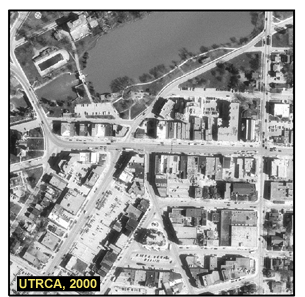
The 2000 Orthoimagery of the entire Upper Thames River Conservation Authority (UTRCA) Watershed is in MrSID format at a spatial resolution of 30cm with a 30:1 compression ratio. The file size is approximately 1.72GB.
Coordinate system: UTM - NAD'83, 6° projection, Zone 17.
Central Meridian 81° West.
Aerial photography scale: 1:20000
Aerial photography date: April 2000
Ground pixel resolution: 30cm
Source format: 'SID' World.
Library Call Number: GD.CA.05 (Regional)
Restrictions on Access / Use
This resource is available to University of Western students, faculty and staff for academic, research or personal reasons. The UTRCA should be cited in any maps or graphics generated. Patrons will be required to sign a release form when requesting the data. Data must be requested in person at the Map and Data Centre Reference desk.
Sample View of the Data
Stratford City Centre - Stratford, Ontario - 1:10,000