
Ontario Municipal Boundaries GIS Data
The Ontario Ministry of Municipal Affairs and Housing has created a vector based GIS dataset for the different levels of municipal boundaries in Ontario at a data capture map scale of 1:10,000. The Boundary files are current to January 1st, 2004. The file size of the entire vector dataset is approximately 177mb.
Coordinate system: Geographic (Lat. and Long.) - NAD 83.
Source format: ESRI Shapefiles (ArcGIS/ArcView)
Updated: 2004
Library Call Number: GD.CA.18 (Ontario)
Available Themes / Layers
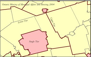
Boundaries - Single Tier, Lower Tier, Upper Tier and Districts.
Restrictions on Access
This resource is available to University of Western Ontario students, faculty and staff for academic, research or personal reasons. Patrons will be required to present a valid UWO ID card and sign a release form when requesting the data. Data must be requested in person at the Map and Data Centre Reference desk.
Data Manipulation / Usage
The Map and Data Centre has 2 GIS workstations equipped with ArcGIS 10.0 and other software to explore/manipulate the data. UWO users may also copy requested resources to a data storage device (ex. USB flash drive, CD-R) for research or teaching use outside of the library. The Ontario Ministry of Municipal Affairs and Housing should be cited in any maps or graphics generated.
Sample View of the Data
Municipal Boundaries in the London, Ontario area
Sample Citation
Ontario Municipal Boundaries [computer file]. Toronto: Ontario Ministry of Municipal Affairs and Housing, 2004.