Landsat 5 Satellite Imagery Data
2004 Local / Regional Landsat 5 Imagery
The 2004 Landsat 5 Image of London and Surrounding area was acquired by the University of Western Ontario, Western Libraries for research use.
Satellite / Sensor: Landsat 5 TM
Path (Track) / Row (Frame): 19 / 30
Scene Date: September 15, 2004
Bands: 1, 2, 3, 4, 5, 6, 7
Ground pixel resolution: 30m
Source format: GeoTIFF (each band is contained in a separate file)
Library Call Number: GD.CA.03 (Regional)
Restrictions on Access / Use
This resource is available to University of Western students, faculty and staff for academic, research or personal reasons. Patrons will be required to sign a release form when requesting the data. Data must be requested in person at the Map and Data Centre Reference desk, Monday to Friday between 8:30am and 4:30pm.
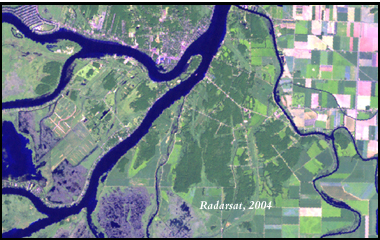
Sample View of the Data
Pseudo-natural Colour Composite (Bands 7-5-3) of Walpole Island, Ontario

1991 Local / Regional Landsat 5 Imagery
The 1991 Landsat 5 Image of London and Surrounding area was acquired by the University of Western Ontario, Western Libraries for research use.
Satellite / Sensor: Landsat 5 TM
Path (Track) / Row (Frame): 19 / 30
Scene Date: August 11, 1991
Bands: 1, 2, 3, 4, 5, 6, 7
Ground pixel resolution: 28.5m
Source format: GeoTIFF (each band is contained in a separate file)
Restrictions on Access / Use
This resource is available to University of Western students, faculty and staff for academic, research or personal reasons. Patrons will be required to sign a release form when requesting the data. Data must be requested in person at the Map and Data Centre Reference desk.
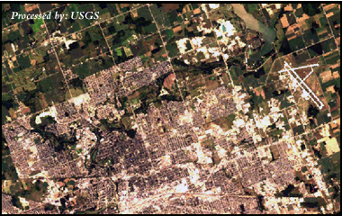
Sample View of the Data
True Colour Composite (Bands 1-2-3) of North London, Ontario


